Monday, December 07, 2009

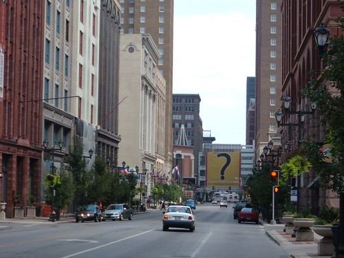
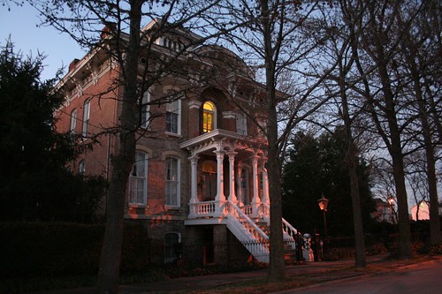
Dissecting Soulard

Where ever I live, I pride myself on not being that guy who, when his friends come from out of town, is seeing the sights for the first time right along with them. Whatever the big attractions are, I become familiar with them in short order. By the time visitors arrive, I can tell them all about whatever they want to know.


Soulard is certainly one of St. Louis's top attractions, and my first photographs there are now over a decade old. I've visited it many times. So it was a surprise to find how little I've photographed there. However much you wander across a neighborhood, you don't find out what you have and haven't documented until you try to put it on a map.

On reflection, in my endless quest to find the city's more exotic, far flung, forgotten, neglected, and endangered corners, I have always regarded photo expeditions to Soulard as a guilty pleasure, an overdone cliche, something to be avoided in favor of seeking out places and buildings that might not be there tomorrow. In spite of its near-demise after World War II, Soulard today seems like a safe bet to stay put. So I've never put in the serious hours there needed to truly document it and capture its essence.


Nonetheless, I have gotten many of the highlights and landmarks, and present them on a humble tour of Soulard. This will be the first of many south St. Louis tours, and some day it will be more extensive. It doesn't fully capture the charm of this amazing neighborhood, but it's a start.

Monday, August 24, 2009

This and that

Encountered this article while cleaning out email:

* "Saving a Sense of the City" - Michael Allen shows a sampling of endangered south side buildings

In other news, the San Luis is coming down. I was in town in July and wistfully snapped a few photos of it before the wreckers could get too far along.

Last days of the San Luis

The fight to assert preservationist rights in St. Louis, however, is still going on:
* "Why the Friends of the San Luis Continue"

Thursday, June 04, 2009

Death of a lens

My basic workhorse camera lens has reached the end of a long, painful death. It covered the medium-to-wide range (18-55mm), and it is damn difficult to photograph city buildings without it!

If anyone out there has a spare wide-angle lens for a Canon Digital Rebel they need to get rid of, or knows where I can pick up one on the cheap, drop me a line. This was the style of my old one, but anything that covers the 18mm zoom region would be swell.

Monday, May 25, 2009

Of overwhelming scale

Michael Allen has posted photos of McEagle's May 21st presentation slides at Flickr. At last, the initial schemes are visible to the public.

In general, the slides are fairly unrevealing. Several show the near north side as it currently stands (minus the last year or so's worth of demolitions.) There are a few abstract diagrams showing things like the project area, proposed land uses and schematic building layouts.

Particularly frightening is an acquisitions map showing property that McKee has (or apparently thinks he can get via the city) in blue. It's an ocean of blue, dotted with some little white islands. What's it like to be living on one of those islands right now, watching the waters rise as they have for the last five years?

There's not a whole lot to react to in the plan; all that can be seen are vague generalities. There is one big question to be asked, though: Why does it need to be so big?

What about this plan requires such a vast acquisition? What kind of synergies are planned here that require this scale?

The question is very important, because this land is in the city - an urban environment with all the complexities that entails. Anybody who's studied their Jane Jacobs -- or taken a stroll down a functioning urban street like Delmar Avenue or Cherokee Street -- knows that the best city environments are highly complex and largely organic. They grow and thrive much like a living creature. Small cells appear -- businesses, houses, apartment buildings. They divide, they grow, they endure, and each adds its complexity to the whole, creating something greater than the mere sum of its parts. These small parts are crafted at the scale of human beings, and they create lovely, pleasant, desirable places to live. Just as a complex ecology resists being wiped out by a catastrophe, so too is a complex city resistant to the vagaries of economy, fashion, and time.

So why does this project need to be so huge? Why does it need to happen all at once? We need to ask such questions, because such a vast scale implies a monoculture, and it implies a broad brush, and it implies a non-human scale, and it implies sledgehammer solutions to problems that require a scalpel.

In fact, it sounds a lot like old-style mid-century urban renewal -- the kind that wiped out big swaths of Soulard, that nearly claimed Lafayette Square, that obliterated the Mill Creek Valley, that gave us phenomenal successes like Darst-Webbe and Pruitt-Igoe. The kind we're still cleaning up from over fifty years later.

To insist that redevelopment can only be done on a vast scale shows a profound lack of understanding of the nature of cities.

Here's my hypothetical suggestion instead: start with Old North St. Louis, a neighborhood that's long been pulling itself up by the bootstraps. Take the 30 or so Blairmont-owned buildings in the neighborhood, and rehab them all. Sell some, rent some, do a mix of market-rate and income-restricted, whatever -- just get them occupied and looking healthy again. Thirty properties, figure maybe $50,000 apiece on average to get them up to snuff -- $1.5 million in initial investment. If I'm way off on my estimate, maybe it's $3 million -- somewhere in that ballpark.

That's chump change to a fellow with McKee's pockets, but it would be a HUGE shot in the arm for a neighborhood the size of Old North. Thirty vacant properties, gone in a flash! If Paul McKee Jr. had done this three years ago, the locals would've carried him down the streets on their shoulders. And aside from the trust and good will that would've been built up, the neighborhood would be visibly stronger, that much more desirable, more attractive to other developers --

-- so much more, in fact, that you could then maybe start spreading the success across West Florissant, into St. Louis Place. Rehab another thirty houses between Florissant (a major barrier) and St. Louis Place Park (a desirable amenity lined with occupied houses). Suddenly eastern St. Louis Place is on its way to becoming as strongly entrenched as Old North.

Phase 3? Well, now that you've reinforced your assets, then you can start to think a little bigger. There's a lot of vacant land in Old North - how 'bout some infill? How 'bout pushing west of the park? A big project out on the 22nd Street prairie would get a lot of support by this point.

...and so on. If this type of plan had been started in 2003, we'd be through several grand ribbon cuttings by now.

This is how cities -- not suburbs, not strip malls, not shopping malls, not lifestyle centers, but cities -- have grown for hundreds of years, and it is a pattern and a truth that we ignore at our own peril. Attempts to inflict massive change inevitably result in massive trauma.

This doesn't take money ranging into the billions of dollars. This doesn't take five years of land acquisition. This doesn't take endlessly gargantuan juggling acts. This doesn't require monolithic land assets or totalitarian site control or eminent domain.

It does, however, require understanding that a true and proper city is vastly complex, finely grained and multifaceted. Furthermore, it takes patience and care. Paul McKee Jr. has demonstrated that he is endlessly patient. Whether he cares remains to be seen, but to date the track record does not look good.

Wednesday, May 13, 2009

At last, the first inklings of a plan

At a community meeting this week, representatives of Paul McKee's McEagle development company met with residents of the north side neighborhoods targeted by Blairmont and its sister shell companies, and announced their grand vision for the area.

Because the meeting was targeted at local residents and not open to the press, full details are still forthcoming (specifically, at an upcoming May 21st meeting.) Attendees have reported a wide-ranging plan, encompassing "job centers", retail and residential. The details seem to be rather skimpy at this point, particularly in light of looming funding deadlines. Questions and comments from the area's residents are reported to have been fiery and uncompromising, befitting McEagle's years of abusive tactics in the neighborhood.

The Post-Dispatch recounts more of the details here and here.

I really haven't heard enough details to have a real reaction. There's been nothing to indicate if the plan involves clear-cutting existing houses, or if preservation will be a priority. Nothing about how urban or non-urban the new construction will be - will this be about rebuilding the city or reproducing the suburbs in its place? No visuals released to the public yet, and you can't really talk about buildings without visuals. I'm slightly heartened that McEagle is at last, finally, talking to residents, acknowledging a plan, getting information out there. But after all this time, it's only a minimal start.

Friday, February 13, 2009

Love-in for the San Luis!


Tomorrow, on Valentine's Day, Saturday, February 15th at 12:00pm noon, urbanists, architecture buffs, and plain common-sense folks will come together at Lindell & Taylor to celebrate St. Louis's MidCentury heritage by showing the love for the former DeVille Motor Hotel.

The St. Louis archdiocese plans to demolish the building and replace it with a surface parking lot. The group hopes to promote a preservation and reuse plan, which could benefit both the church and the neighborhood.

Read more at www.NoParkingLotOnLindell.com.

Sunday, January 18, 2009

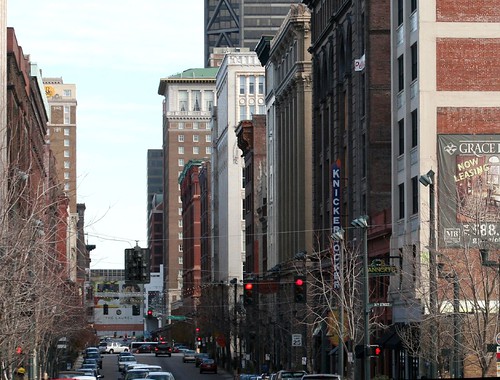
Washington Avenue revisited

It's been several months in the making: the Washington Avenue tour is now completely revitalized and up to date.

Washington Avenue ?

So much has happened on the Avenue, and my own standards for page and image format have risen so much, that a complete revamp was the only option. I've re-scanned all the old photographs, in many cases setting them alongside new ones taken on my most recent St. Louis trip or in the intervening years. Huge amounts of information about many of these buildings is now available online, and I've pulled some of that together as well. I even snuck in the Tudor Building, which featured on a very early version of Built St. Louis but had since fallen off the radar.

Washington Avenue

The transformations are amazing. Dingy, battered storefronts have been reworked all up and down the Avenue. Dirty facades have been cleaned and repaired. The 2004 streetscape improvements have transformed the area's vibe.

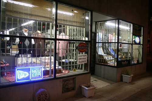
Levin's by night

The last fragments of the street's old life, its gritty urban and garment district days, are fading away. Of all the storefront operations visible from the street, only a handful predate the 1990s (Levin's, Levine Hat Company, Mankofsky Shoe Company, possibly the relocated Erlich's Cleaners). Most are less than five years old, and almost none of the businesses I photographed in 2001 remain today.

Washington Avenue neon

But the new generation of businesses has brought new life to the street, people and light, neon signs and sidewalk dining. Rising from its threadbare state of ten years ago, Washington Avenue has become the most urbane street in St. Louis.

Saturday, January 03, 2009

The mournful town of Cairo, Illinois

Nearly two hundred years ago, settlers began trying to construct a town where the mighty Ohio and Mississippi Rivers came together. Intimately tied to the water and the river trade, Cairo, IL rose to great fortunes in its heyday.

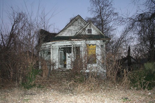
But the river trade changed, and the fortunes of economy passed Cairo by. Today the town is a sad shell of its former self, its glory long wilted.

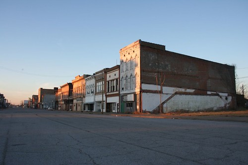
Commercial Street

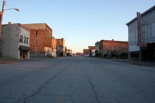
This is Commercial Street, the main shopping street of the town back in the day. I arrived about 4:30pm on January 2nd, a Friday. The street looked like this: empty. Deserted. Not a soul was to be seen. No cars. No lights. No people. Nothing.

Commercial Street

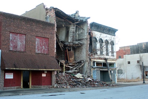
Three or four solid blocks of Victorian commercial buildings have been left to rot. Some are literally collapsing onto the sidewalk. Others are gutted, every piece of glass shattered.

Commercial Street collapse

Nearby Washington Avenue is doing better, and has most of the city's businesses. It is a more suburban-styled street, but has some architectural gems.

The town's struggles with racism are legendary. In the late 1960s, the city's black community organized a boycott against segregated white-owned businesses. The owners so adamantly refused to give in that one by one they simply went out of business, over the course of a few years.

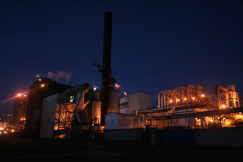
Those days may be past, but the city's struggles continue. The town's fall probably has as much to do with the overall centralization of river traffic as any problems created by racism. Cairo isn't much of a port anymore. The Interstates have passed it by, and there isn't much room to grow. The Bunge Corporation maintains a soybean processing plant there, and railroads still loop around and through the town, so little Cairo isn't entirely off the economic map. But there is little else.

Bunge Corporation

Cairo's geography is unfathomable. Sited on a narrow wedge of land between the two rivers, it is perpetually in danger of being washed away by the whims of the mighty rivers. Thus a huge levee rings the entire town. To the south, one simply drives over it. But to the north, where land is lower, a gargantuan metal gate descends to close off a tunnel through the railroad embankment when flood waters rise.

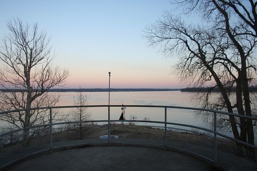
Confluence

At Fort Defiance Park, one can literally stand at the confluence, the exact point where two thousand miles of river join together. The two channels unite to form a river nearly a mile in width. The view is awe-inspiring. The water was nearly level with the park land on the evening of my visit, an obvious warning of the rivers' power.

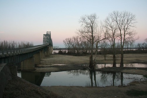
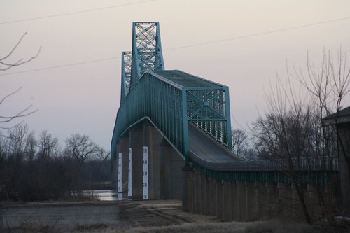
Two mighty bridges cross the rivers, connecting the city to Kentucky to the east, and Missouri to the west. They carry two-lane roads, long surpassed by I-57 to the west.

Ohio River Bridge

Mississippi River Bridge

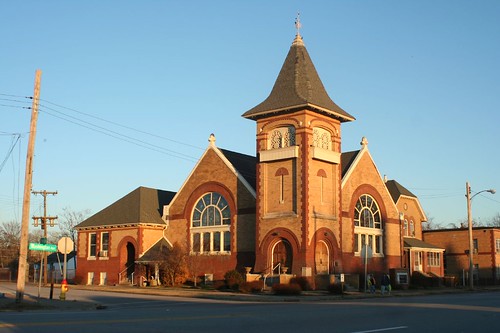
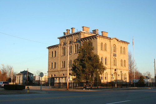
Traces of Cairo's glory days remain. Scattered churches, mansions, and public buildings have been restored and maintained.

Cairo First Presbyterian Church

Cairo Custom House

Whopper of a house

But they sit in a landscape wrought with the physical signs of abandonment, of despair: empty lots, reclaimed by forest. Wrecked and ruined buildings. Streets leading nowhere.

Ruins

It's hard to imagine a bright future for long-suffering Cairo, but there remains a peculiar beauty to its ruins, amplified by its precarious place upon the fickle rivers.

Links:
* More photos
* Cairo, IL at Wikipedia
* Mississippi River web site page on Cairo.