Nearly two hundred years ago, settlers began trying to construct a town where the mighty Ohio and Mississippi Rivers came together. Intimately tied to the water and the river trade, Cairo, IL rose to great fortunes in its heyday.
But the river trade changed, and the fortunes of economy passed Cairo by. Today the town is a sad shell of its former self, its glory long wilted.
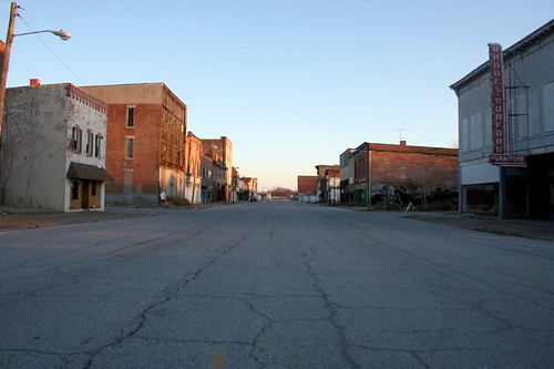
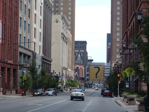
This is Commercial Street, the main shopping street of the town back in the day. I arrived about 4:30pm on January 2nd, a Friday. The street looked like this: empty. Deserted. Not a soul was to be seen. No cars. No lights. No people. Nothing.
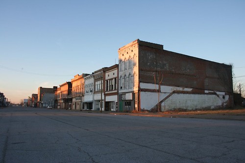
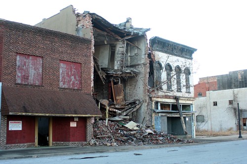
Three or four solid blocks of Victorian commercial buildings have been left to rot. Some are literally collapsing onto the sidewalk. Others are gutted, every piece of glass shattered.
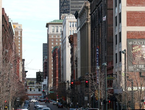
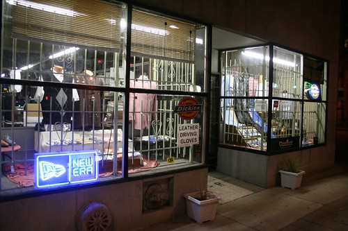
Nearby Washington Avenue is doing better, and has most of the city's businesses. It is a more suburban-styled street, but has some architectural gems.
The town's struggles with racism are legendary. In the late 1960s, the city's black community organized a boycott against segregated white-owned businesses. The owners so adamantly refused to give in that one by one they simply went out of business, over the course of a few years.
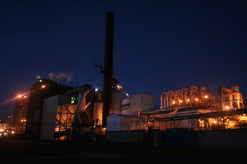
Those days may be past, but the city's struggles continue. The town's fall probably has as much to do with the overall centralization of river traffic as any problems created by racism. Cairo isn't much of a port anymore. The Interstates have passed it by, and there isn't much room to grow. The Bunge Corporation maintains a soybean processing plant there, and railroads still loop around and through the town, so little Cairo isn't entirely off the economic map. But there is little else.
Cairo's geography is unfathomable. Sited on a narrow wedge of land between the two rivers, it is perpetually in danger of being washed away by the whims of the mighty rivers. Thus a huge levee rings the entire town. To the south, one simply drives over it. But to the north, where land is lower, a gargantuan metal gate descends to close off a tunnel through the railroad embankment when flood waters rise.
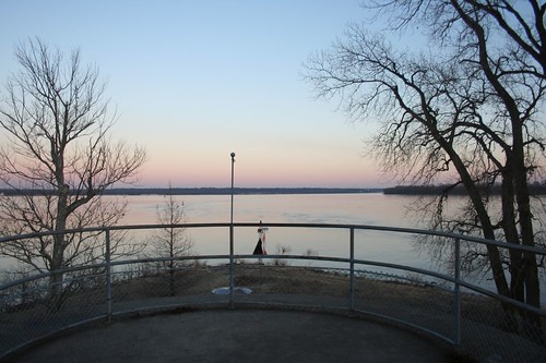
At Fort Defiance Park, one can literally stand at the confluence, the exact point where two thousand miles of river join together. The two channels unite to form a river nearly a mile in width. The view is awe-inspiring. The water was nearly level with the park land on the evening of my visit, an obvious warning of the rivers' power.
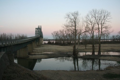
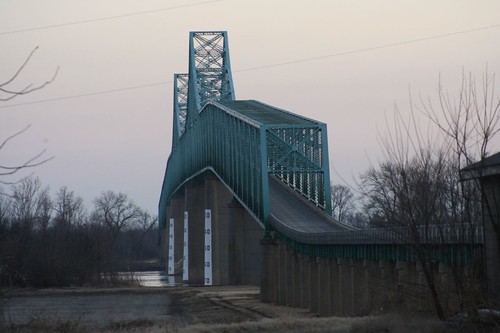
Two mighty bridges cross the rivers, connecting the city to Kentucky to the east, and Missouri to the west. They carry two-lane roads, long surpassed by I-57 to the west.
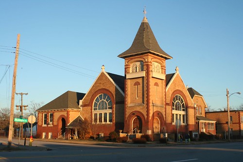
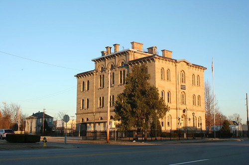
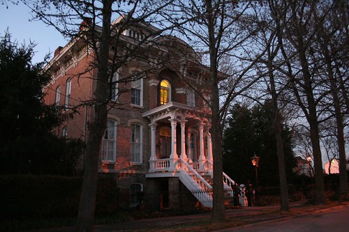
Traces of Cairo's glory days remain. Scattered churches, mansions, and public buildings have been restored and maintained.
But they sit in a landscape wrought with the physical signs of abandonment, of despair: empty lots, reclaimed by forest. Wrecked and ruined buildings. Streets leading nowhere.
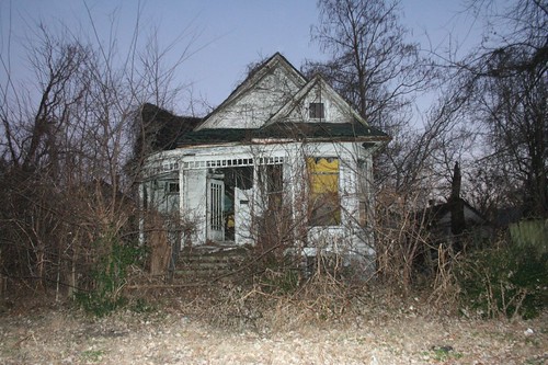
It's hard to imagine a bright future for long-suffering Cairo, but there remains a peculiar beauty to its ruins, amplified by its precarious place upon the fickle rivers.
Links:
*
More photos*
Cairo, IL at Wikipedia
*
Mississippi River web site page on Cairo.